Mount Dolmed

Haakon

Administrator
Staff member
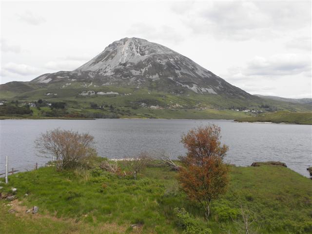
This is a mountain that is part of the Blue Mountains. The Dwarves build their cities close to it. Perhaps it looks something like this? We see the Ascar to the lower left (it probably grows a bit further down towards Gelion). (Actually, I'm not totally satisfied with the positions here, I would have liked the river to flow from right to left)
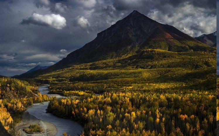
269241-nature-landscape-Alaska-mountain-forest-river-fall-clouds-trees-748x467.jpg

(The picture is from somewhere in Alaska I believe)
 
I like the picture, but somehow i always thought of dolmed as a round mountain - don't know if the texts suggest that in any ways.

I think of the erwd luin as more like not- so- high irish mountains...

The mourne mountains for example would fit my image pretty well.


Dolmed means wet head... Why is it called that? Is it a dying glacier or maybe a hill on which typically rainclouds break? I actually live in such a hilly lowland region... The higher terrain in the west to us breaks the clouds and where i live it is permanently rainy bad weather..
 
Last edited:
I think as you suggest that Dolmed is a mountain where rainclouds break.

Do you think this mountain is too high? I don't think it looks that high... It just has a pointy peak.
 
No it's not quite that. I've seen some mts with head names... Wolfs head, lion head, indiana head... Some are pointy indeed, so there's no direct contradiction. It's just my personal imagination always painted a different picture..
 
To me that looks a bit mixed.
And I do think that Mount Dolmed should be a mountain rather than a hill.
 
Well i was postimg the pics because i always had the impression that dilmed was a peak that was abit removed or set apart from the rest of the mountain range.

Do we all agree about the exact position of dolmed and the dwarf ciries? I remember that there was a bit of confusion or debate about their geographical setting.
 
I don't have a particularly strong opinion other than that their cities lie close to Mount Dolmed, which is a bit removed from the Ered Luin, just as you say.
 
hmm... in case of that that might be another point for us to discuss.

I do not believe that the Dwarves of the Firebeard and Broadbeam tribes awoke beneath mt Dolmed. Instead i think they awoke in the northern Parts of the Ered Luin, close to the Iron Mountains (on the same longitude as Gundabad - or we decide to put them under Dolmed and Dolmed between the 55° and 56° degree of Longitude!) and moved southwards... they built the Dwarven road alond a suitable pass or gap within the Ered Luin and useful Fords along the Rivers of Ossiriand, both Cities should lie a bit north and South of Dolmed. As Beleriand is vaguely as large as Eriador (a thing many maps get wrot wrong by depicting Beleriand too large!) i think somewhere between 75 and 200 miles north and south of Dolmed would be reasonable... 150 miles would be a distance i preferred, but looking at the pubsil map i'd say Belegost is closer to dolmed while Nogrod is farer away to the southeast, maybe 75 miles or more.
 
Last edited:
Ah, yes... The Ascar could be a border between evergreen and deciduous forests, to a greater or lesser degree. I’m not sure I’d like it to be so definite, I think we should see both kinds of trees on both sides of the river. But I absolutely agree with you in general.
 
Since Dolmed is wet, but also a mountain, how tree-covered is it? How high is the treeline, how high is the snowline, and are there glaciers?

I do agree it needs to stand out a bit westward from the other mountains, and the two cities are probably north and south of it.
 
Back
Top